How Harvey Hurt Houston, in 10 Maps
Even before Hurricane Harvey hit, Houston was no stranger to devastating rainstorms. The city got two "100-year" storms in the two years before Harvey made landfall. All three storms flooded thousands of houses, many outside of the Federal Emergency Management Agency's flood plains.
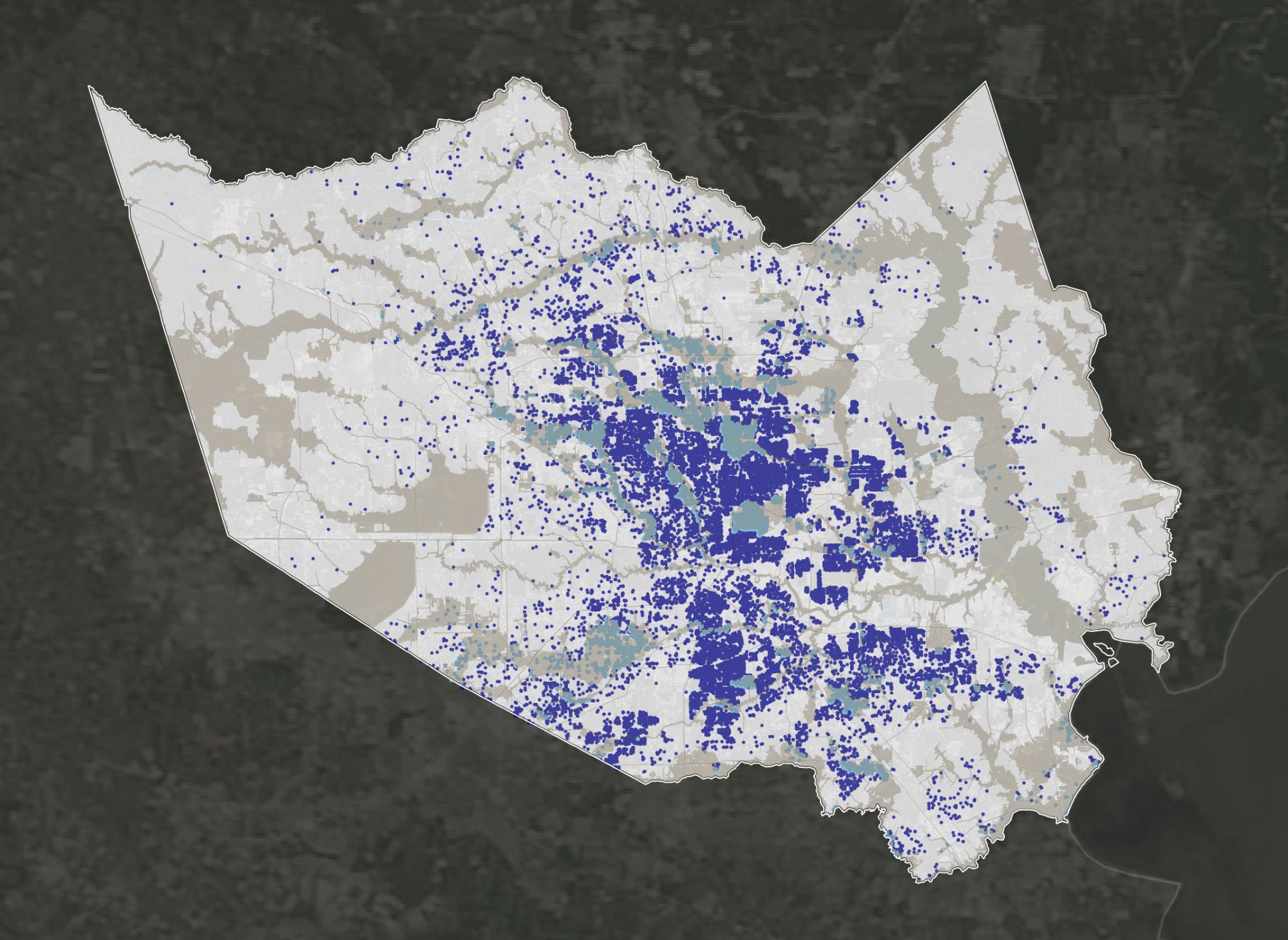
Here’s What Flooded in the Houston Area During 2001’s Tropical Storm Allison.
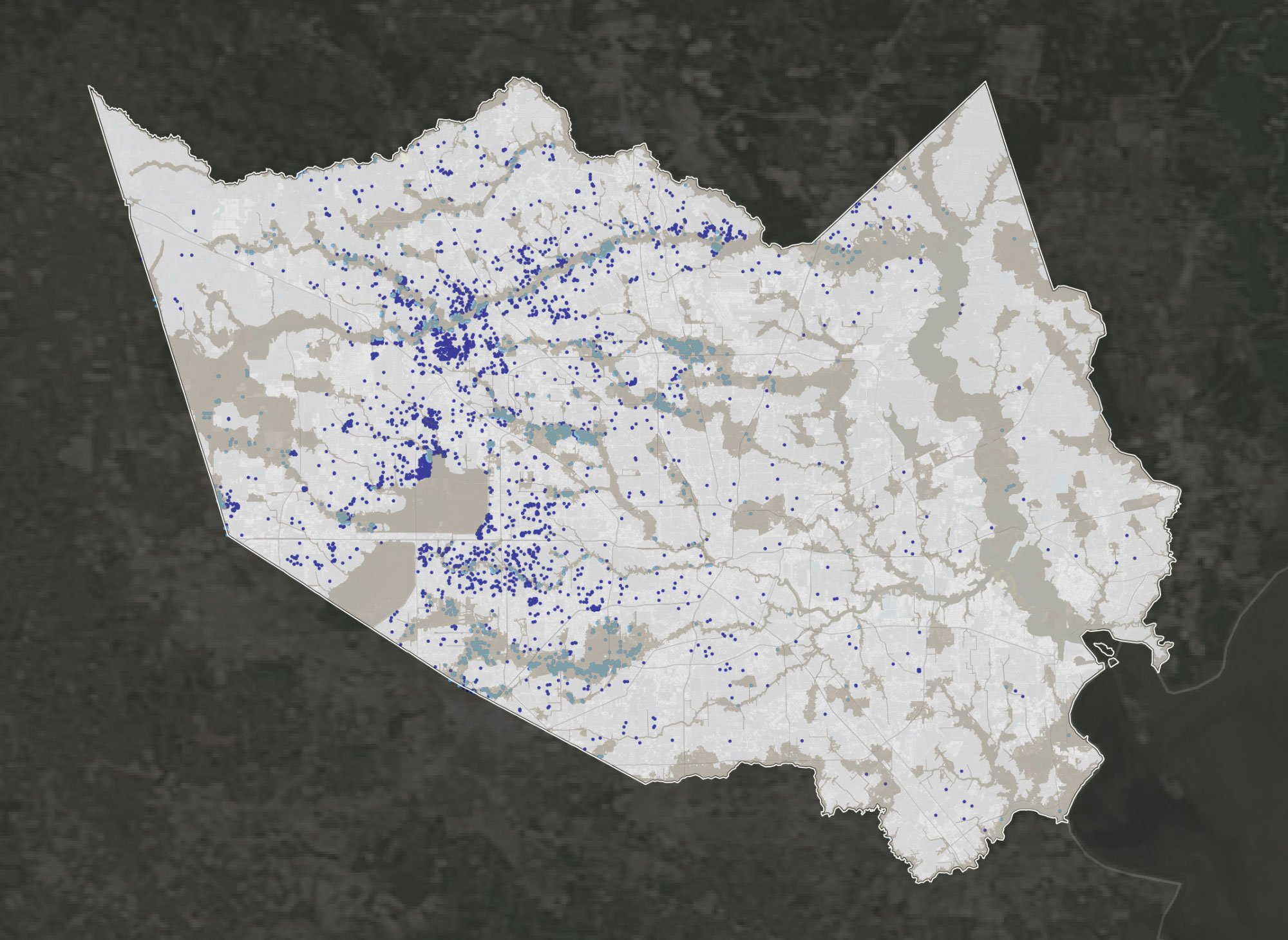
Here’s What Flooded in the Houston Area During 2016’s “Tax Day” Flood
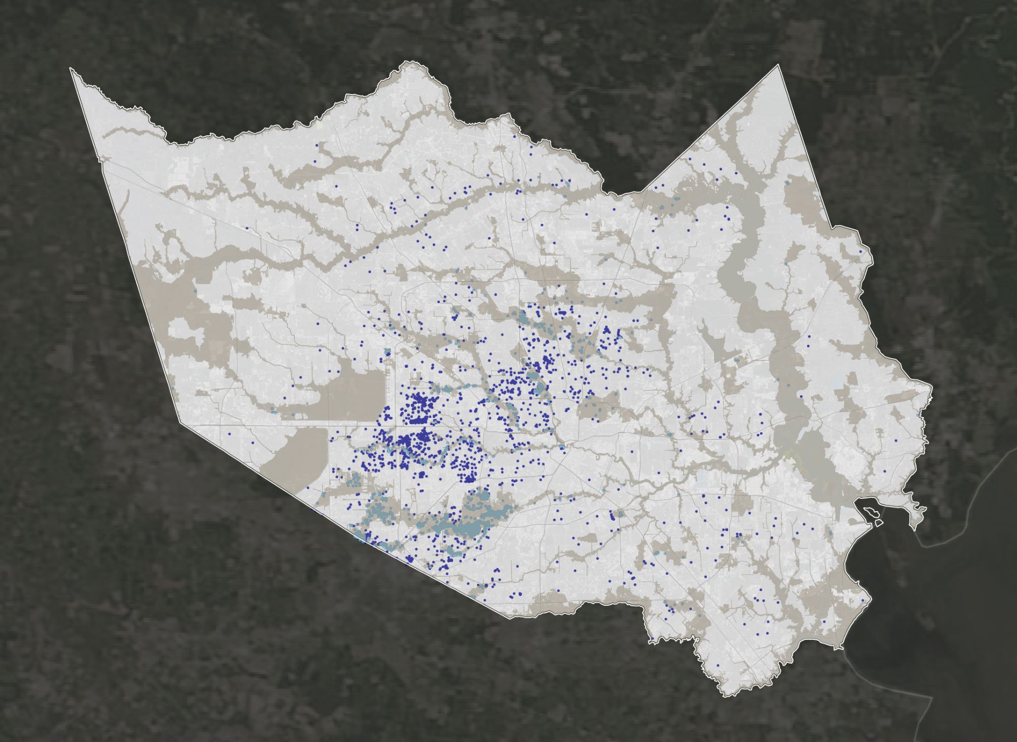
Here’s What Flooded in the Houston Area During 2015’s “Memorial Day” Flood
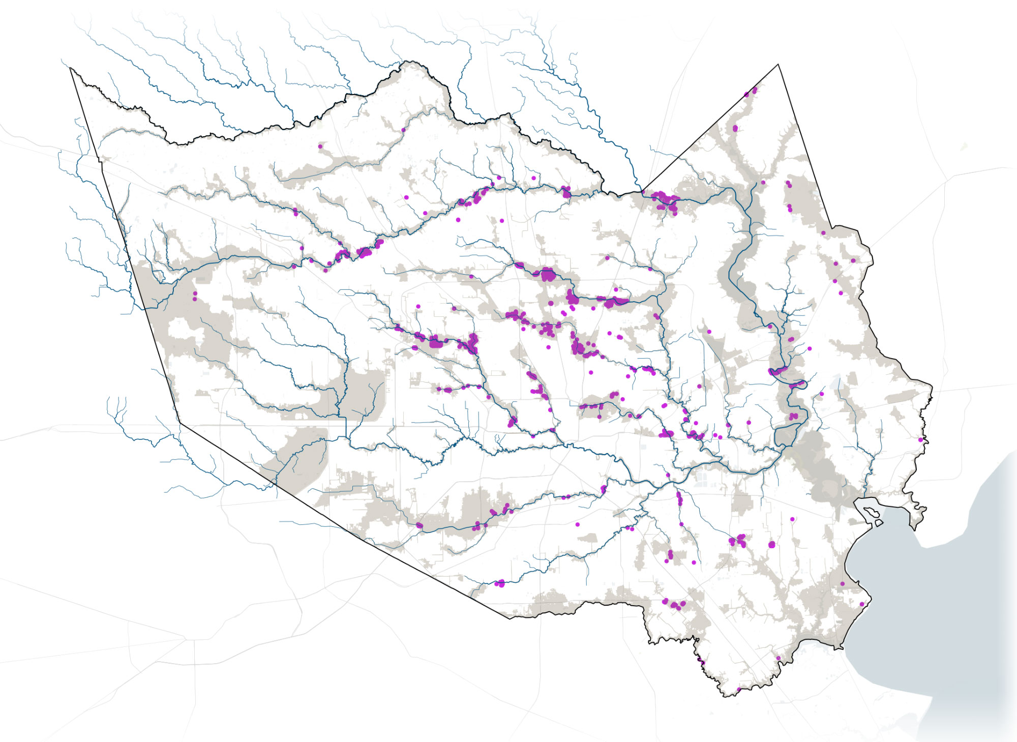
Here’s Where Land Was Developed in the Houston Area Between 2001 and 2010
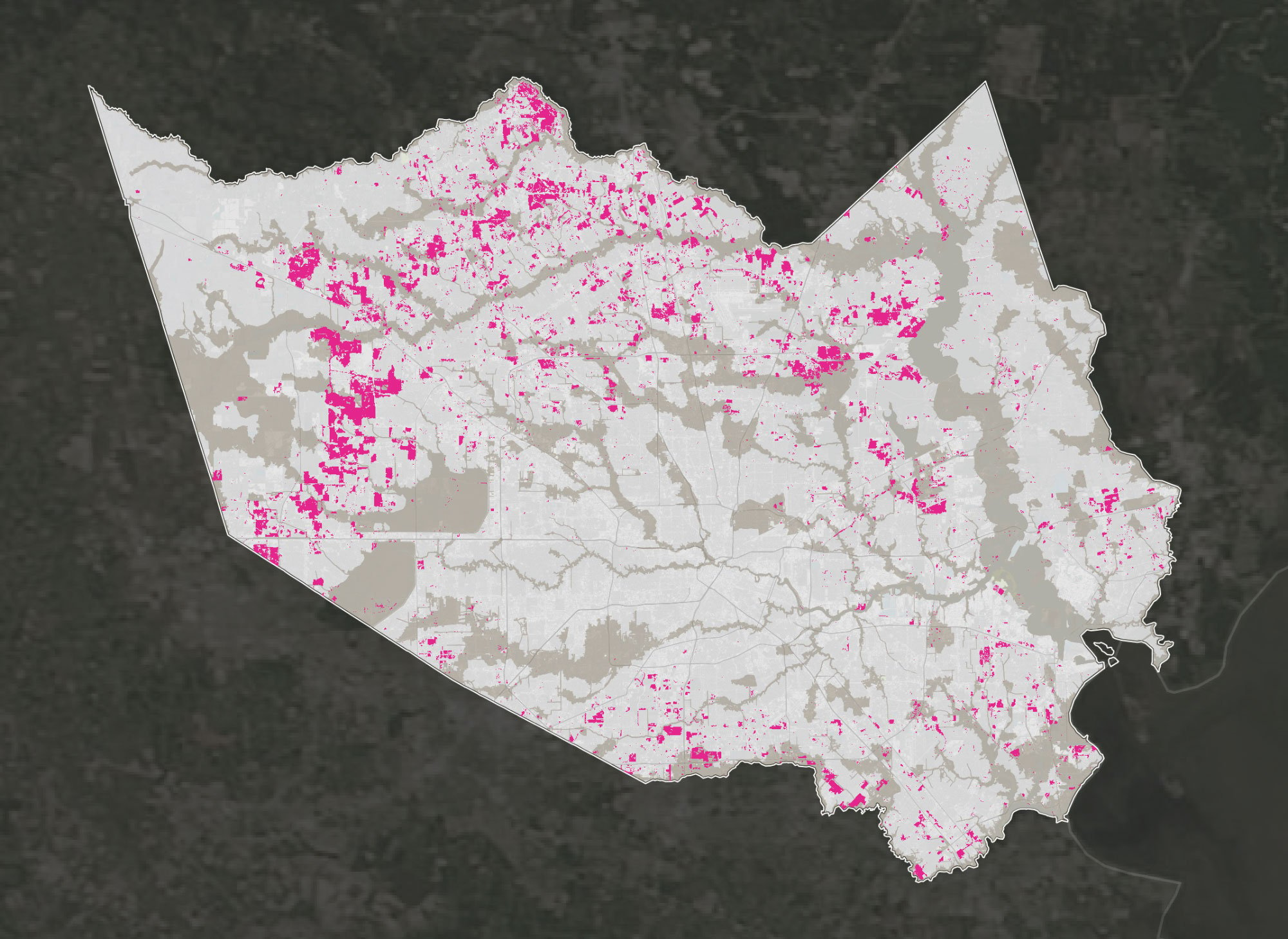
Sources: Harris County Flood Control District, Houston Advanced Research Center, FEMA, USGS/NASA Landsat
ProPublica and the Texas Tribune in 2016 warned of the potential impact of a massive storm on Houston's petrochemical industry and low-lying suburbs.
Many scientists, experts and federal officials say Houston's explosive growth is largely to blame, along with climate change. As millions have flocked to the metropolitan area in recent decades, local officials have largely rejected stricter building regulations, allowing developers to pave over acres of prairie land that once absorbed large amounts of rainwater. In the decade after Tropical Storm Allison in 2001, about 167,000 acres were developed in Harris County, home to Houston.

Since the government subsidizes flood insurance, critics say the program encourages people to live in risky areas. You can get a sense of the scale of Houston's intense flooding problem in FEMA's flood insurance data.
In Harris County, there are about 1,100 Severe Repetitive Loss Properties, or properties that have flooded at least five times between 2001 and 2017. FEMA has spent $12 million in repetitive loss claims on 71 properties in the program. In one extreme case, a house in northeast Houston has received 18 flood insurance payments totaling $1.8 million—more than 15 times the property’s market value.
Where the Government Spends to Keep People in Flood-Prone Houston Neighborhoods
More severe repetitive loss properties →
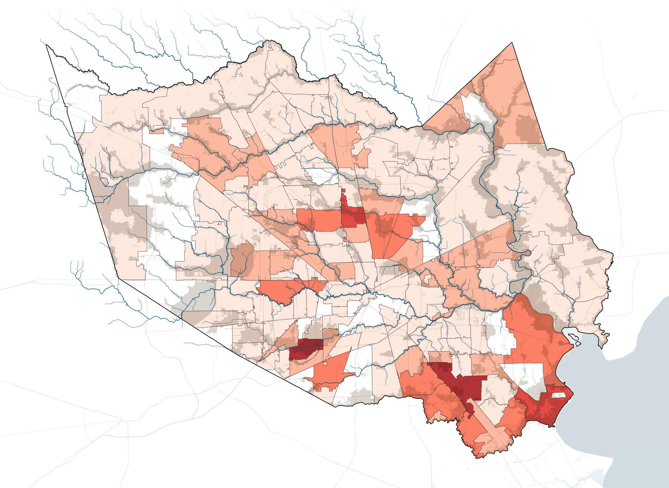
Meyerland
ZIP Code: 77096
Greenspoint
ZIP Code: 77037
Southeast Houston
ZIP Code: 77034
Sources: FEMA via Natural Resources Defense Council, FEMA
Harvey's rains overwhelmed some oil and chemical facilities on the low-lying Houston Ship Channel. After the oil company Valero reported the rain had submerged a floating roof on one of its tanks, residents of the nearby Manchester community reported a scent like "glue or boiled eggs."
The Environmental Protection Agency spent several days taking measurements for the carcinogen benzene, and said that concentrations in the air met Texas' guidelines for the chemical. Environmental advocacy groups that hired a private firm to take its own samples shared detailed data with ProPublica and the Texas Tribune. About 10 of those measurements exceeded California's guidelines, which are 23 times more stringent than Texas', and are well-respected by health advocates nationwide.
Where a Private Monitoring Firm Found High Benzene Levels Near Valero
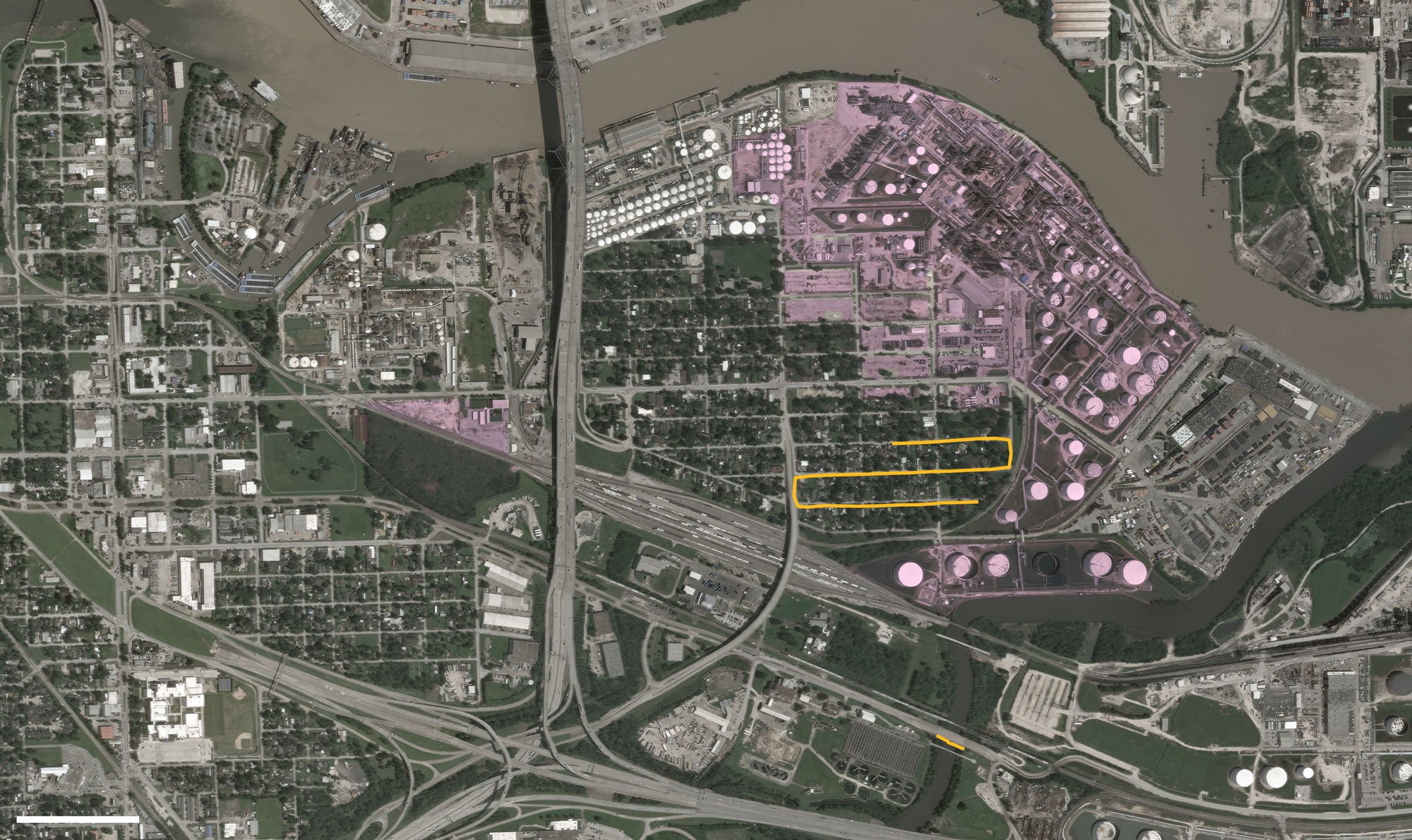
Where the EPA Monitored
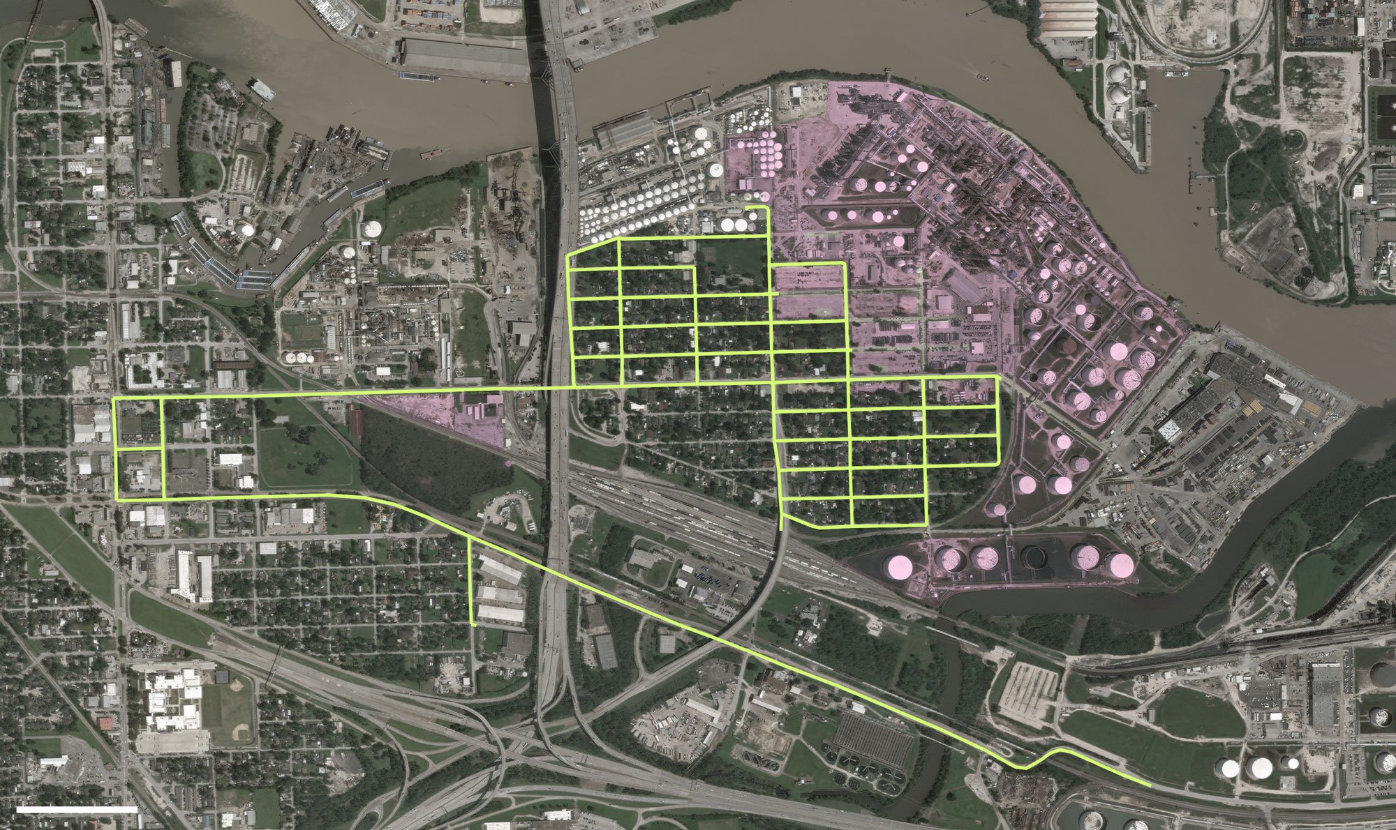
Sources: DigitalGlobe, Entanglement Technologies, EPA
In the 1940's, the U.S. Army Corps of Engineers built two flood control reservoirs on what was mostly empty prairie about 20 miles west of downtown Houston. That system worked well when the reservoirs were surrounded by prairie and rice fields. But in recent decades, development has encroached from all sides. And, in fact, about 14,000 homes are actually located inside the reservoirs.
ProPublica and the Texas Tribune reported that when the Corps originally bought the land that would become the reservoirs, they bought only about 24,500 acres, even though they knew about 8,000 more acres could actually flood in a large enough storm.
Today, much of that unpurchased land is now developed. During Harvey, when more floodwaters accumulated behind the dams than ever before, 5,138 of those homes flooded. At least 4,000 homes have been built inside the reservoirs since Tropical Storm Allison in 2001, which devastated large areas of Houston.
Subdivisions built within the Addicks and Barker Reservoirs stayed flooded for days as the Army Corps of Engineers gradually released water down Buffalo Bayou.

Experts see home buyouts as a cornerstone of disaster resiliency, a way to take the most chronically flooded homes and turn them into open space rather than to pay for endless cycles of destruction and rebuilding. Bought out tracts returned to nature would also improve drainage and lower flood risk for the surrounding area.
Despite the benefits, Harris County has only bought out about 3,100 properties since 1985. That’s fewer than half the homes on the district's priority buyout list. Hurricane Harvey damaged at least 69,000 properties in the county.
The Harris County Flood Control District prioritizes buyouts in neighborhoods where flooding can’t be fixed through engineering. That includes the White Oak Bayou and Greens Bayou watersheds north of downtown Houston, which have seen extensive flooding in recent years. Another watershed — Brays Bayou in the south — has similar flooding problems but got far fewer buyouts, because it has major flood control projects designed to make it less flood-prone. But an analysis by ProPublica and The Texas Tribune found that at least 4,000 Brays Bayou properties in the floodplain still flooded in those years, making it one of the most consistently damaged areas, worse than others with hundreds of buyouts.
Damaged Buildings in the 100-Year Floodplain Far Outweigh Buyouts in 8 Harris County Watersheds
Sources: Harris County Flood Control District, FEMA
Meyerland, a neighborhood along Brays Bayou in southwest Houston, has seen devastating flooding every year since 2015. The area has long been known to be flood-prone, but few homes there have been bought out. Many homeowners found out they were ineligible for a buyout despite being in the floodplain because their homes were not in the area the district calls “hopelessly deep.”
Many Damaged Buildings in Meyerland, but Few Buyouts
Harvey Damages


Sources: Harris County Flood Control District, FEMA